Plymouth County
Plymouth, MA
Storm Report
Impacts Reported
User Submitted Data
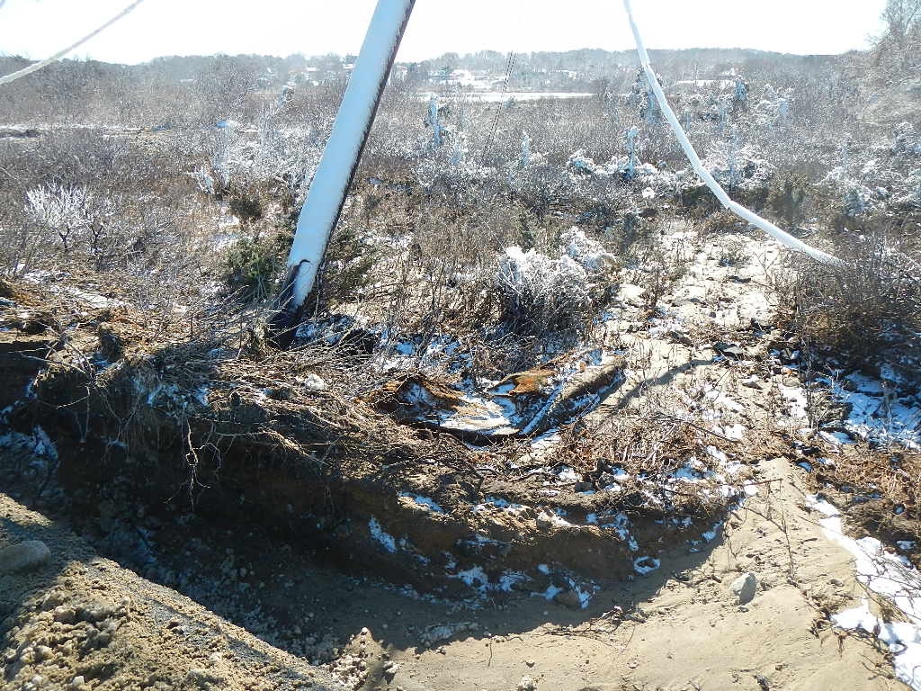
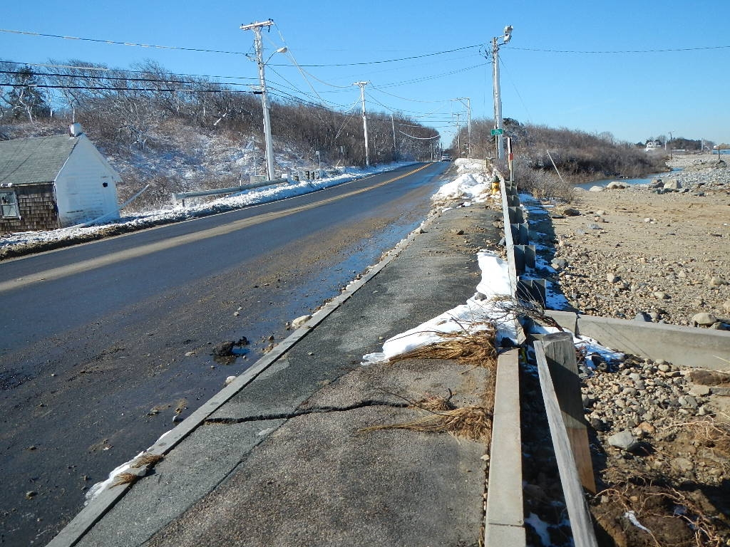
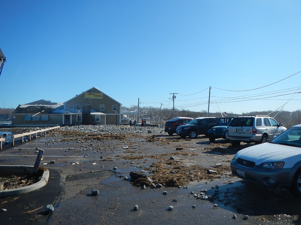
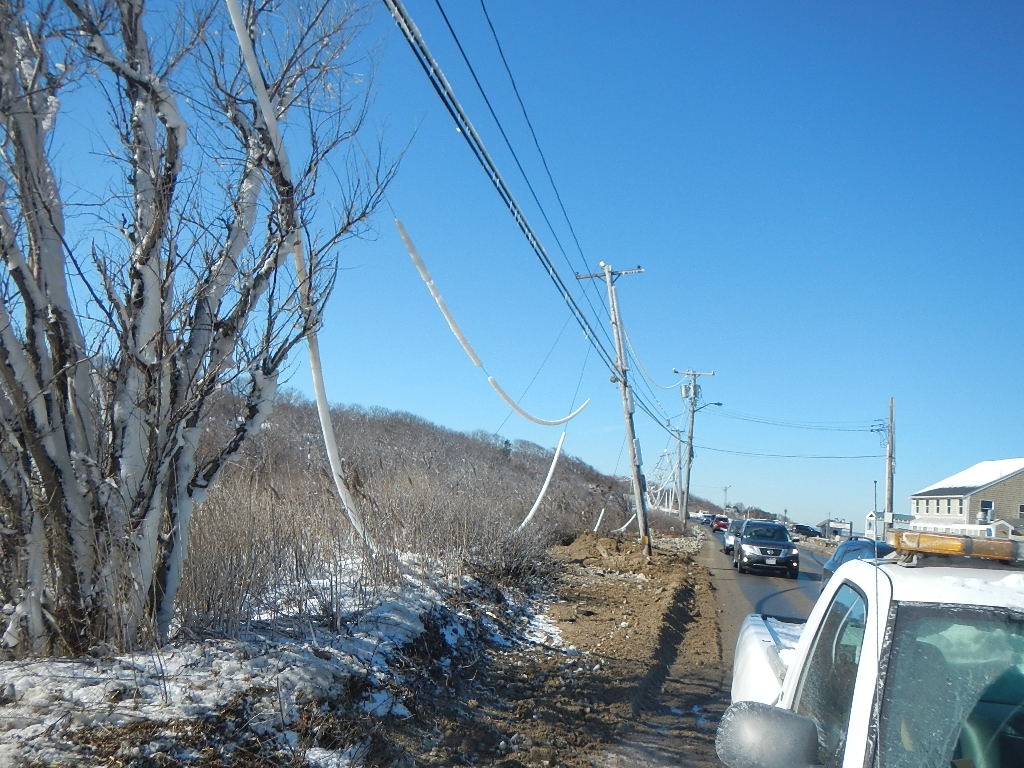
Roads
Street/Road: Unspecified
Specific Impacts:
- Splashover
- Impacted, but passable
- Impassable (flood water)
- Impassable (utility lines)
- Impassable (overwash)
- Impassable (utility poles)
Marinas and Harbors
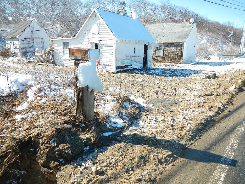
Buildings
Specific Impacts:
- Damaged walls/roofs
- Damaged stairs/decks
- Damaged windows/sidings
- Water flow around or under buildings
Hazardous Materials
Beach
Imapacts Reported: Y
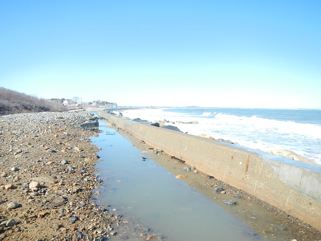
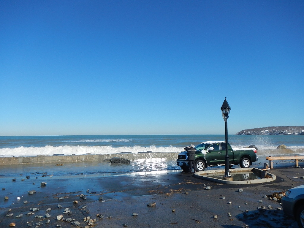
Coastal Structures
Specific Impacts:
- Splashover
- Damaged stairs/walkovers
- Undermined bulkheads/seawalls
Foot/Cycling Paths
Natural Resources
Specific Impacts:
- Eroded beach
- Overwashed beach/dune
Current Response
Response:
- Utility repair
Tidal Overview
![]() 2 hours 40 minutes after high tide
2 hours 40 minutes after high tide
Data from Plymouth (2.5 miles away)
High Tide (Predicted): 11:05 am, 11.6' MLLW
Loading NOAA Tide Data…
■ Observed
■ Predicted water level
⬤ Report time
Weather Overview
Wind Speed: 7.8 MPH
Wind Direction: WNW (284°)
Temperature: 33℉
Rainfall (Calendar Day): 0"
Rainfall (Past 24 Hours): 0.01"
You must be logged in to post a comment.
Waves crashing over seawall 2 hrs after high tide