Plymouth County
Marshfield, MA
(Bay ave #46)
Storm Report
Impacts Reported
User Submitted Data
Roads
Street/Road: Unspecified
Marinas and Harbors
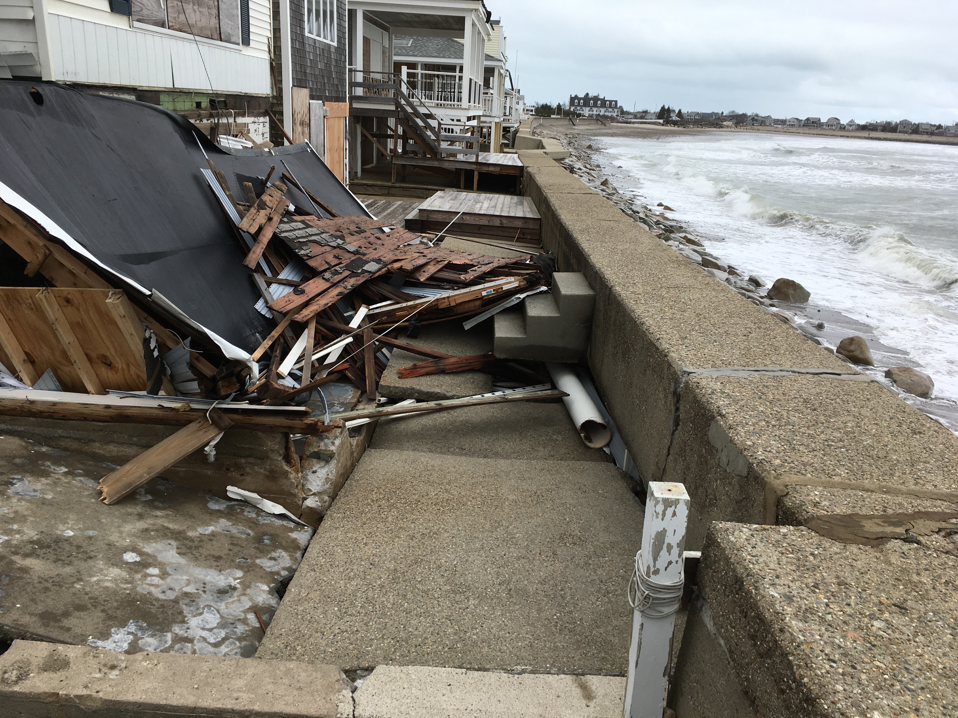
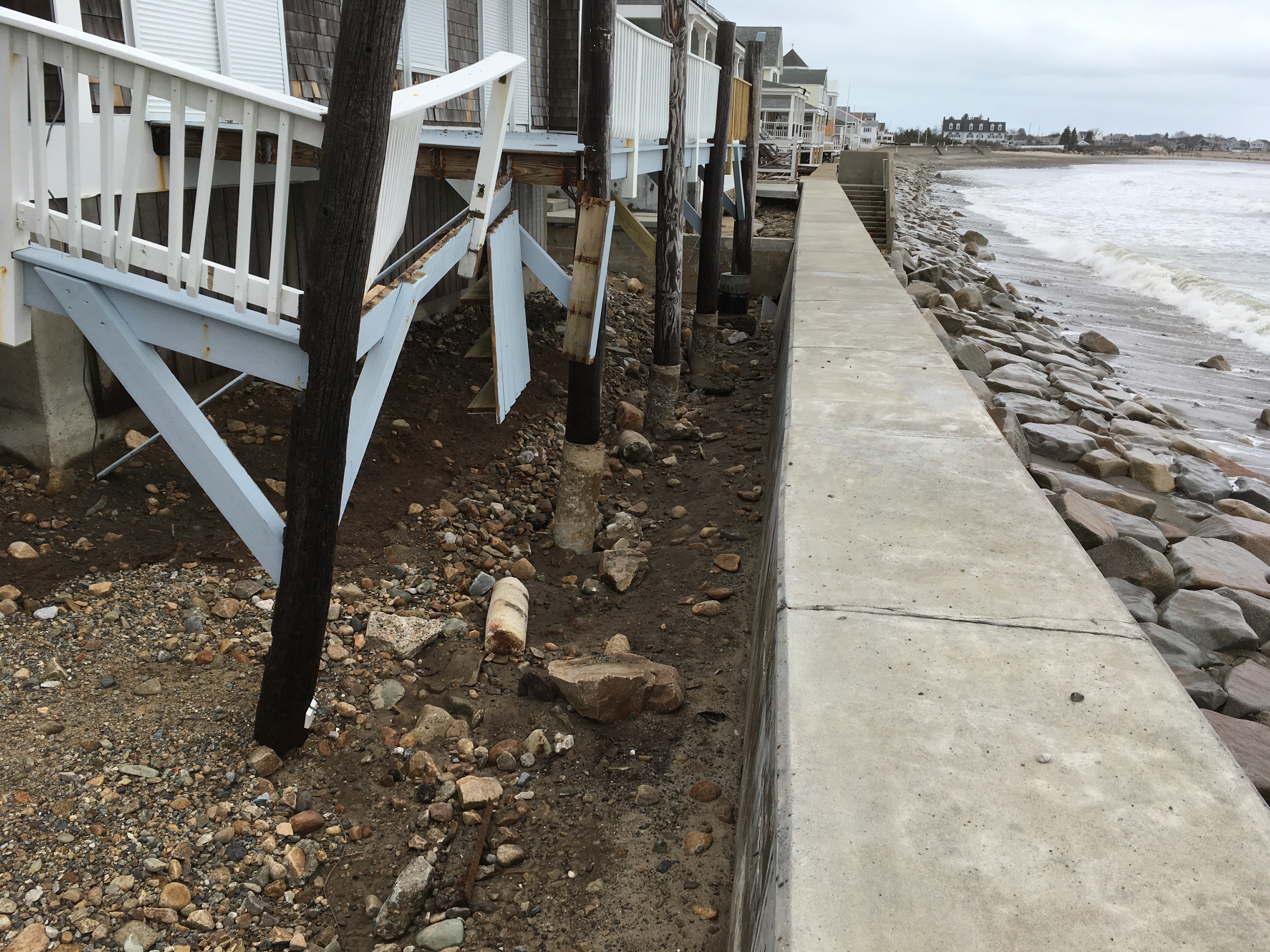
Buildings
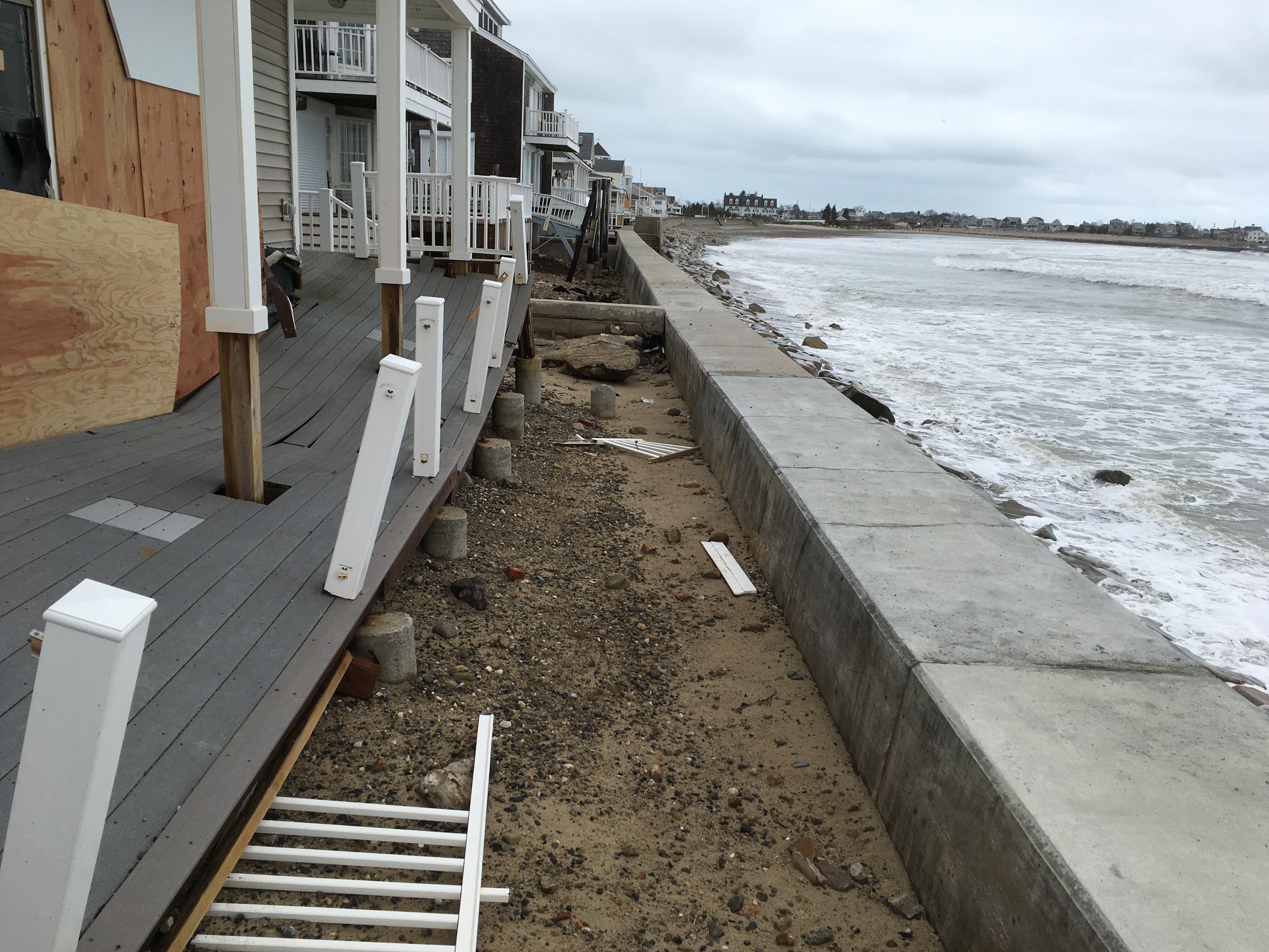
Specific Impacts:
- Water flow around or under buildings
- Damaged stairs/decks
- Damaged windows/sidings
- Damaged walls/roofs
Hazardous Materials
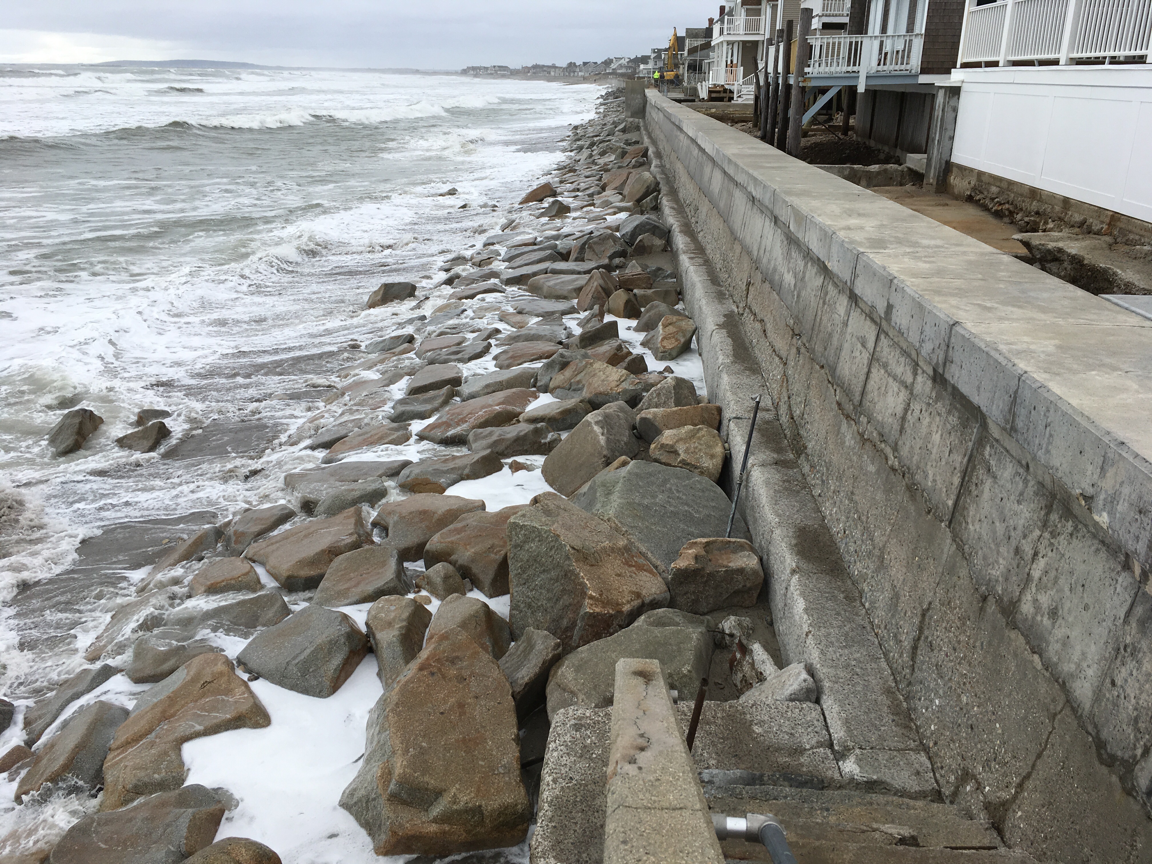
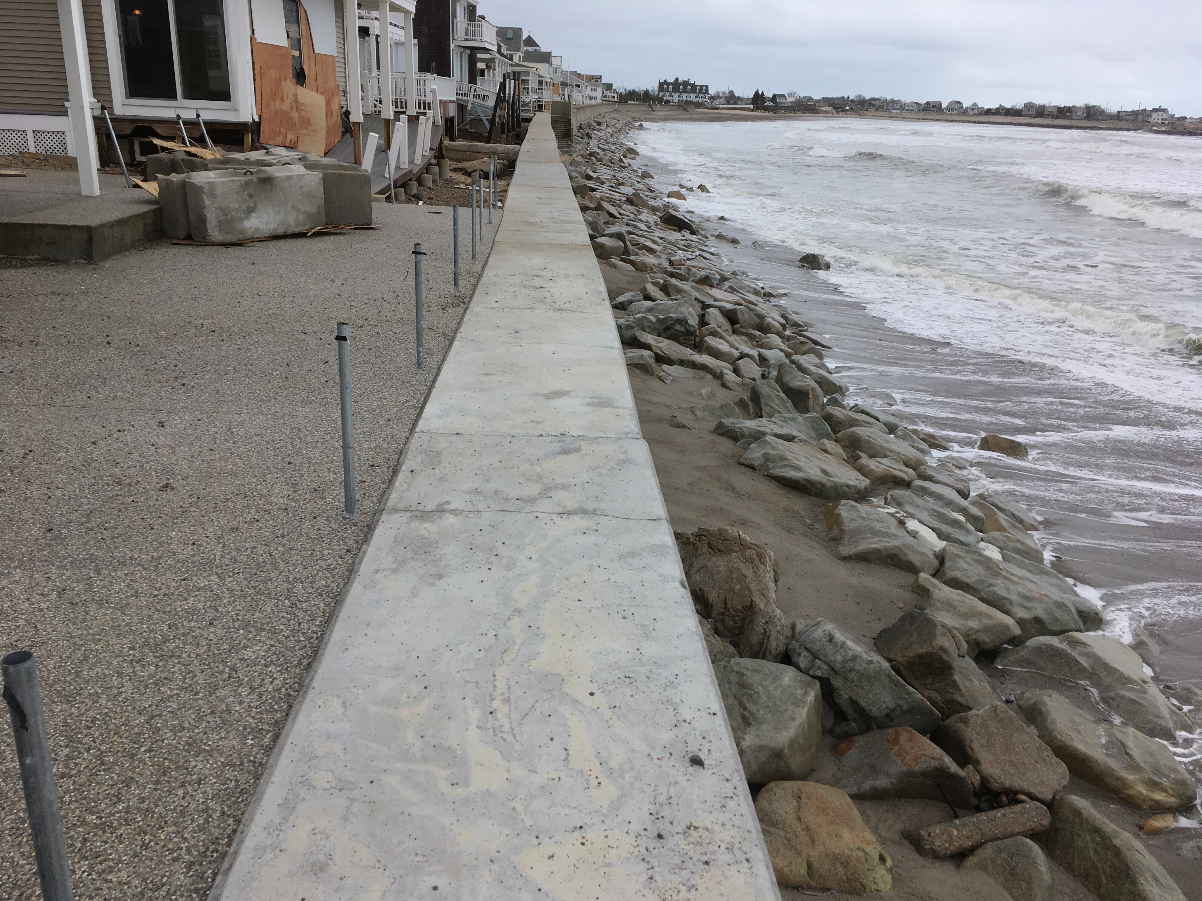
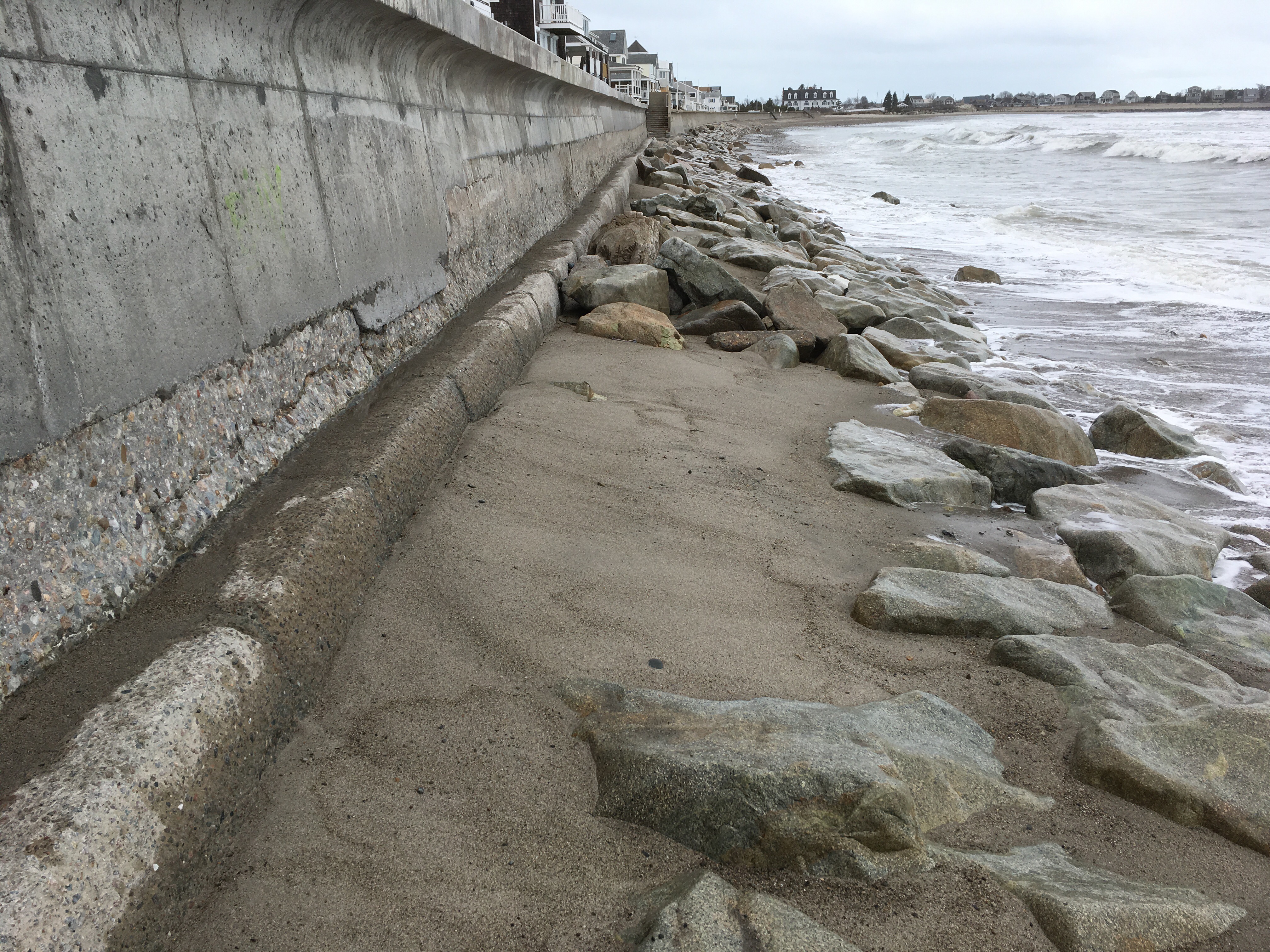
Beach
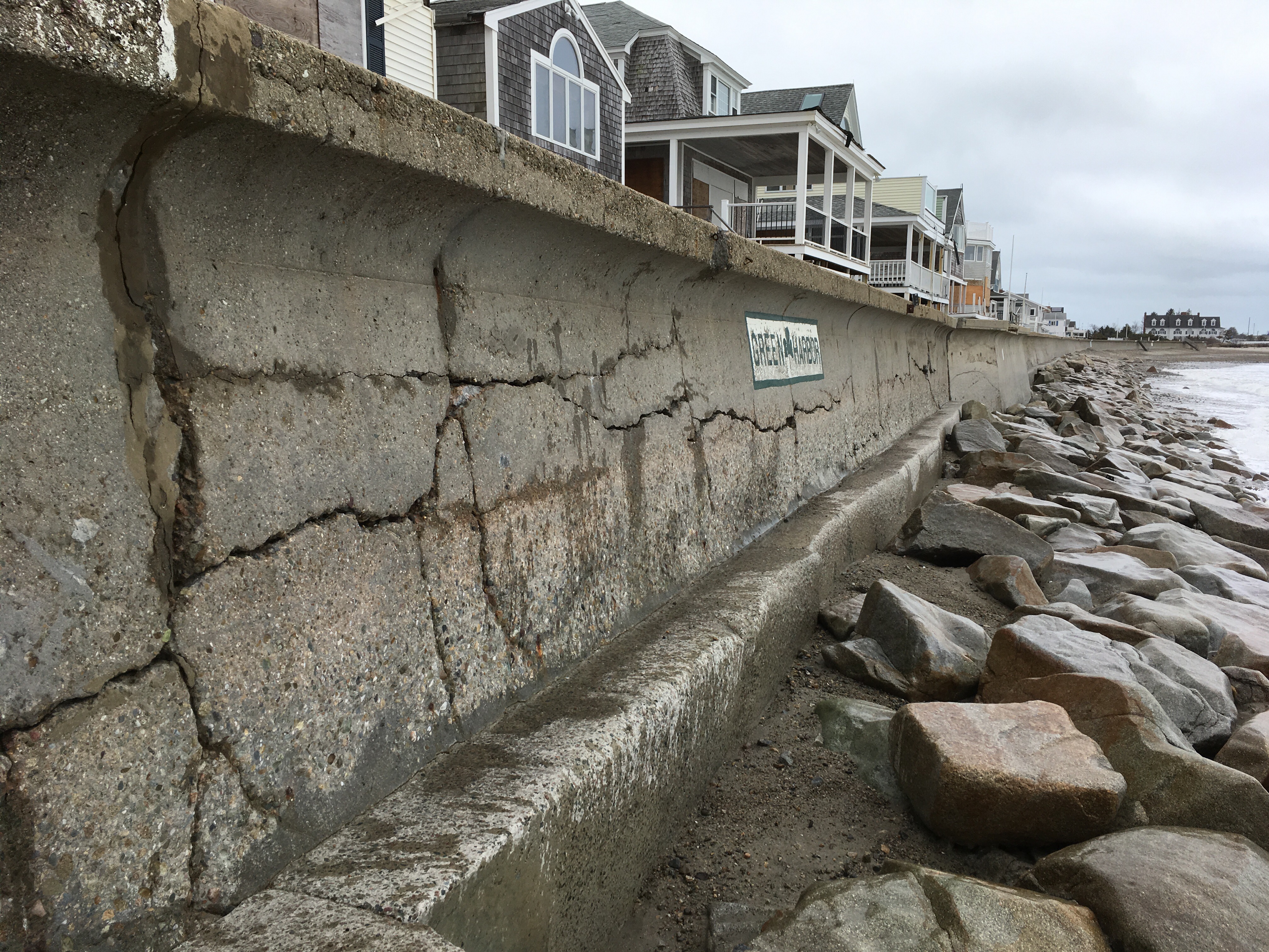
Coastal Structures
Specific Impacts:
- Undermined bulkheads/seawalls
Comments: Significant scour and lowering of beach profile fronting seawall with significant wave scour behind seawall . Horizontal cracking midway up seawall at 70 bay ave which appears to be structural
Foot/Cycling Paths
Natural Resources
Specific Impacts:
- Eroded beach
Comments: Beach eroded exposing footings
Current Response
Tidal Overview
![]() 3 hours 27 minutes before high tide
3 hours 27 minutes before high tide
Data from Brant Rock, Green Harbor River (0.6 miles away)
High Tide (Predicted): 2:38 pm, 9.5' MLLW
Loading NOAA Tide Data…
■ Observed
■ Predicted water level
⬤ Report time
Weather Overview
Wind Speed: 5.4 MPH
Wind Direction: NNE (13°)
Temperature: 36℉
Rainfall (Calendar Day): 0"
Rainfall (Past 24 Hours): 0"
You must be logged in to post a comment.