Marshfield, MA (Brant rock esplinade)
Plymouth County
Storm Report
10/28/2019 | 12:10 pm
Impacts Reported
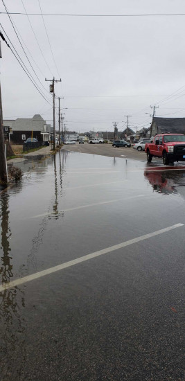

Roads
Street/Road: Unspecified
Specific Impacts:
- Splashover
- Impassable (flood water)
Marinas and Harbors
Buildings
Street: Ocean st.
Specific Impacts:
- Water flow around or under buildings
- Damaged stairs/decks
- Damaged foundations/pilings
Hazardous Materials
Specific Impacts:
- Oil or gas sheen
- Septic
- Other large debris
Beach
State: Accessible
Coastal Structures
Natural Resources
Current Response
You must be logged in to post a comment.