Island County
Camano, WA
Abandoned Boat Report
User Submitted Data
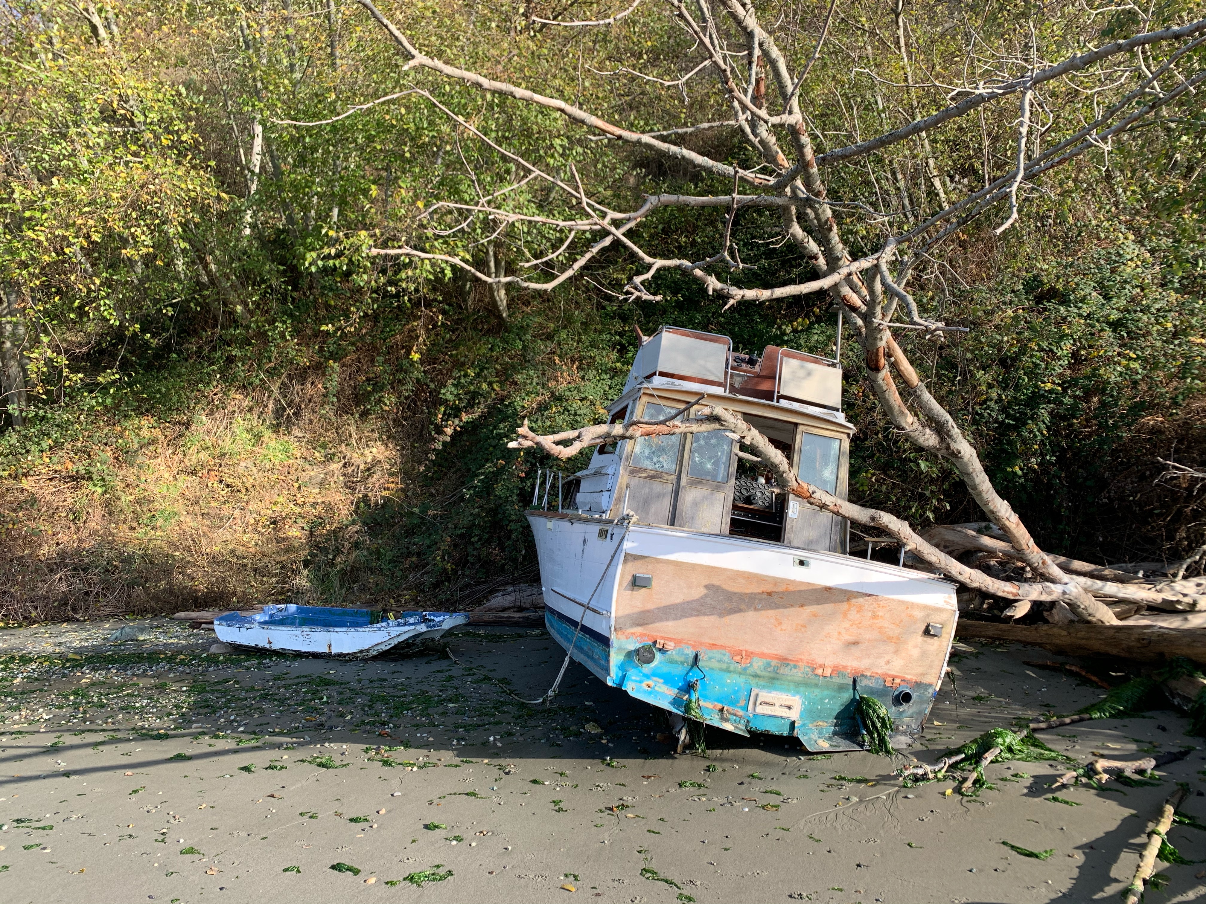
Vessel name: Motor vessel and dingy
Registration Number: Unknown
Hull Type: Wood
Vessel Type: Recreational
Vessel Subtype: Cruising
Vessel is: Aground
Vessel Secured: Tied but not secure
Is Vessel Occupied?: No
Evidence of Other Illegal Activity: No
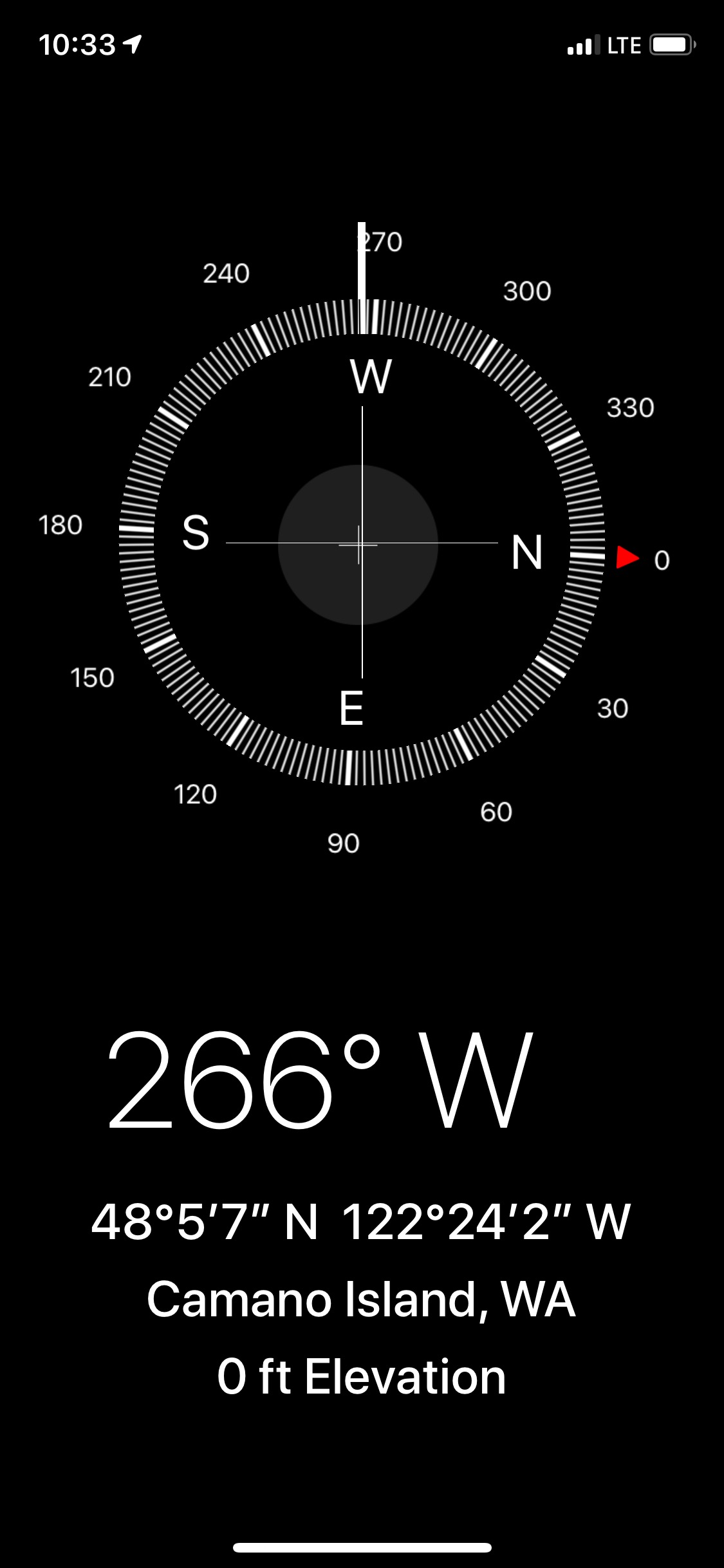
Other Information: GPS coordinates are - 48 degrees 5’ 7” north, 122 degrees 24’ 2” west, Camano Island, WA
Tidal Overview
![]() 3 hours 49 minutes before high tide
3 hours 49 minutes before high tide
Data from Tulare Beach, Port Susan (3 miles away)
High Tide (Predicted): 2:22 pm, 11.9' MLLW
Loading NOAA Tide Data…
■ Observed
■ Predicted water level
⬤ Report time
Weather Overview
Wind Speed: 8.7 MPH
Wind Direction: SW (226°)
Temperature: 52℉
Rainfall (Calendar Day): 0"
Rainfall (Past 24 Hours): 0.03"
1 Comment. Leave new
Thank you for the submission. The Derelict Vessel Removal Program will review this vessel’s information to determine the next course of action. This vessel has been entered into our database as DVRP# IS19-004. If the vessel’s situation changes please make another submission detailing the change.
https://www.dnr.wa.gov/programs-and-services/aquatics/recovering-derelict-vessels