Nantucket, MA (Easton St at Walsh St looking east)
Nantucket County
Storm Report
03/08/2018 | 7:52 am
Impacts Reported
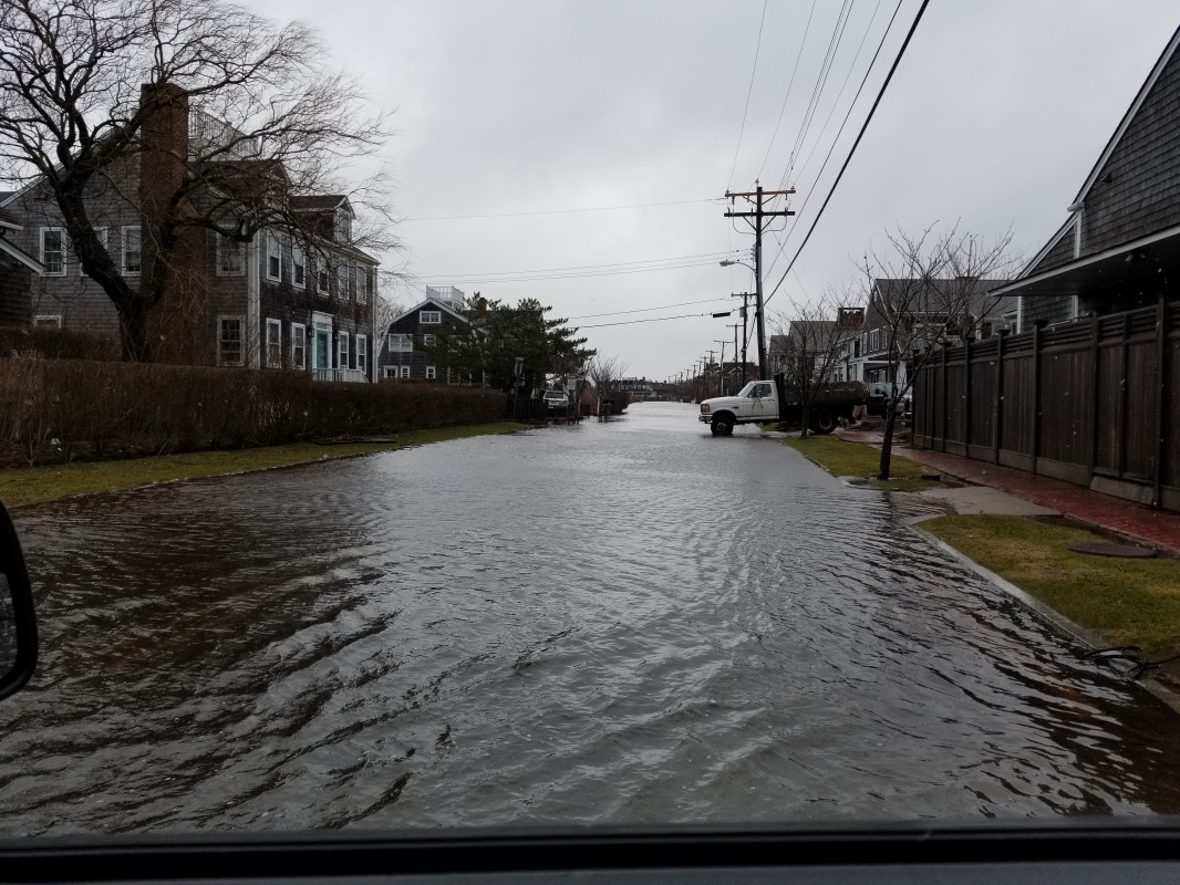
Roads
Street/Road: Unspecified
Specific Impacts:
- Impassable (flood water)
Comments: Tide water remains. Impassable by passenger vehicles.
Marinas and Harbors
Buildings
Hazardous Materials
Beach
State: Accessible
Coastal Structures
Natural Resources
Current Response
Response:
- Other
Specific response: Road closed
You must be logged in to post a comment.