Barnstable County
Provincetown, MA
(Provincetown Pier)
Storm Report
Impacts Reported
User Submitted Data
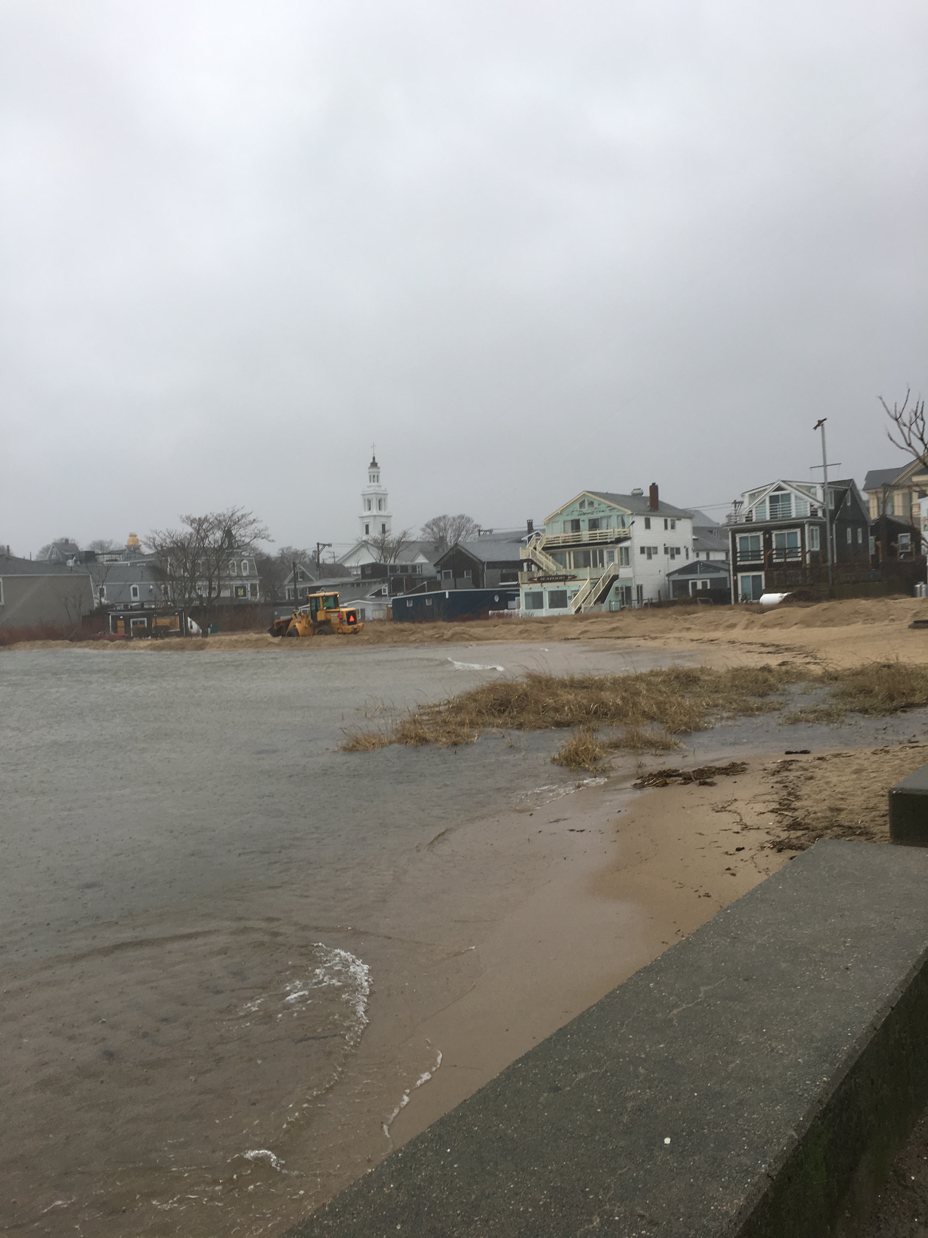
Roads
Street/Road: Unspecified
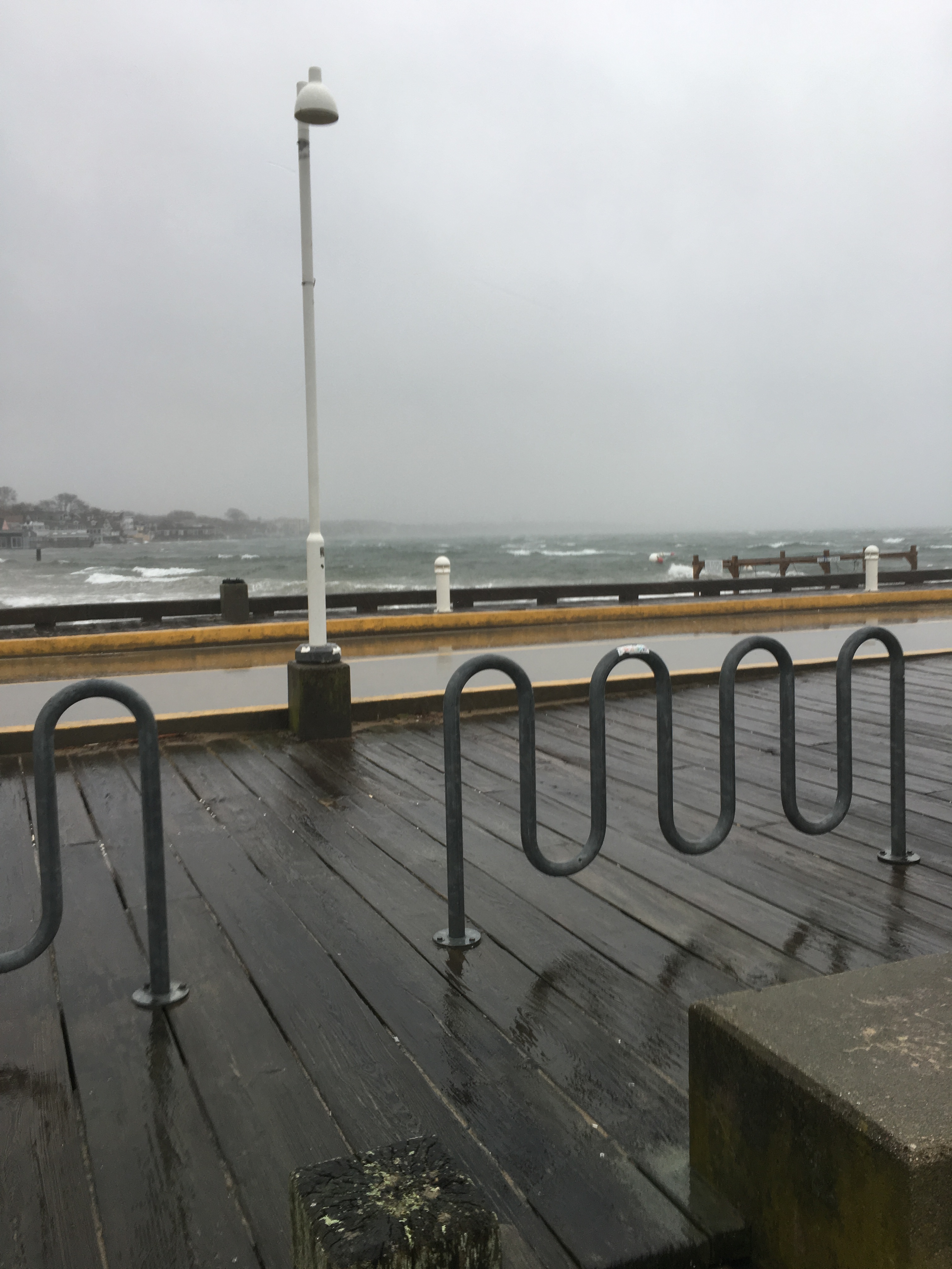
Marinas and Harbors
Specific Impacts:
- Displaced boats
Displaced boats: 1 boat
Comments: Overwash on to pier. Difficult to see through driving rain. One boat displaced and crashed into breakwater (could have happened overnight) later opbserved on 3/3.
Buildings
Specific Impacts:
- Water flow around or under buildings
Hazardous Materials
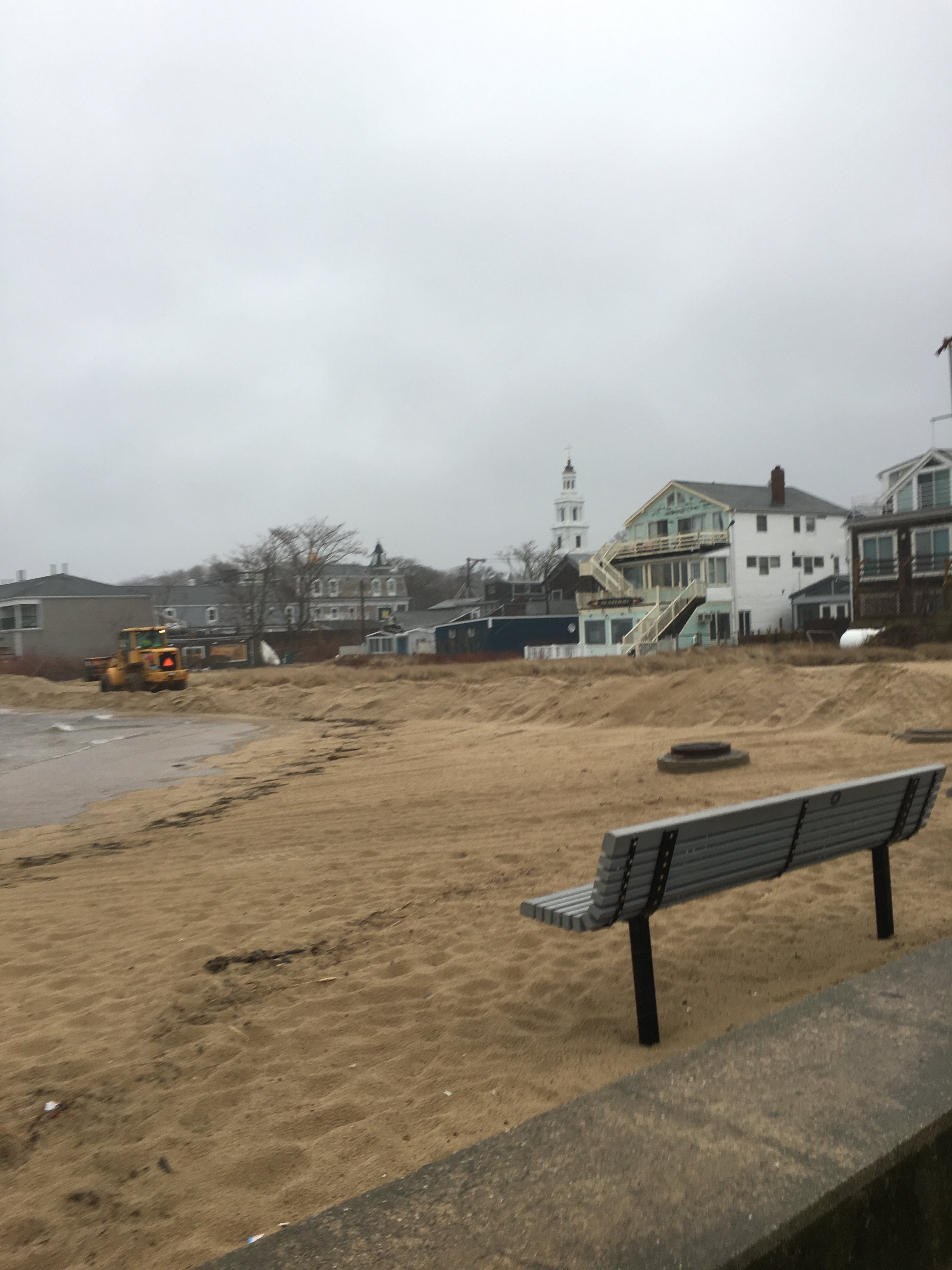
Beach
Coastal Structures
Specific Impacts:
- Splashover
Foot/Cycling Paths
Natural Resources
Specific Impacts:
- Damaged sand fencing
Current Response
Response:
- Dune building
Tidal Overview
![]() 0 hours 16 minutes after high tide
0 hours 16 minutes after high tide
Data from Provincetown (0.2 miles away)
High Tide (Predicted): 11:19 am, 11.2' MLLW
Loading NOAA Tide Data…
■ Observed
■ Predicted water level
⬤ Report time
Weather Overview
Wind Speed: 40.1 MPH
Wind Direction: NE (50°)
Temperature: 44℉
Rainfall (Calendar Day): 0.143"
Rainfall (Past 24 Hours): 0.41"
You must be logged in to post a comment.
Dept. of Public Works building sand wall along town beach.