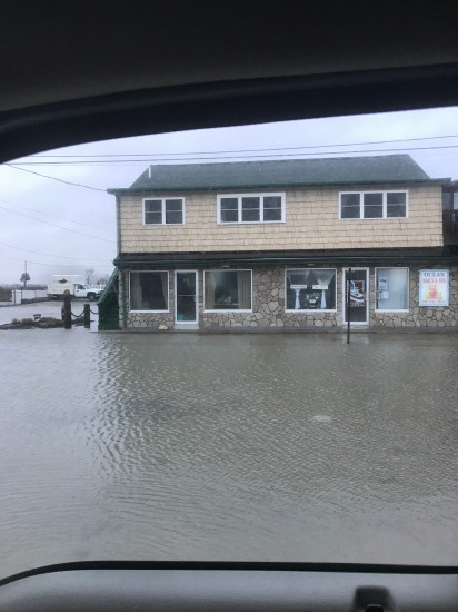
Marshfield, MA (Brant Rock esplanade)
Plymouth County
Storm Report
03/03/2018 | 6:58 am
Impacts Reported
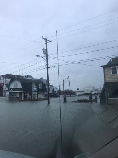
Roads
Street/Road: Unspecified
Specific Impacts:
- Splashover
- Impassable (flood water)
Marinas and Harbors
Buildings
Specific Impacts:
- Water flow around or under buildings
Hazardous Materials
Beach
State: Accessible
Coastal Structures
Specific Impacts:
- Splashover
Natural Resources
Current Response
Response:
- None
You must be logged in to post a comment.