Hull, MA (22 Gunrock Avenue, Hull - Crescent Beach)
Plymouth County
Storm Report
03/03/2018 | 1:28 pm
Impacts Reported
Roads
Street/Road: Unspecified
Specific Impacts:
- Impacted, but passable
Comments: cobble and gravel on the roadway
Marinas and Harbors
Buildings
Street: Gunrock Avenue
Specific Impacts:
- Water flow around or under buildings
- Damaged stairs/decks
- Damaged foundations/pilings
Hazardous Materials
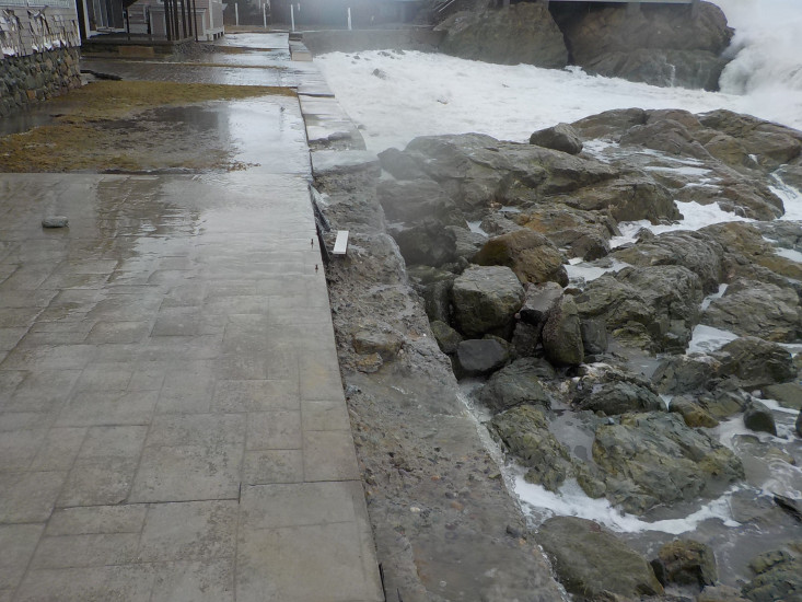
Beach
State: Accessible
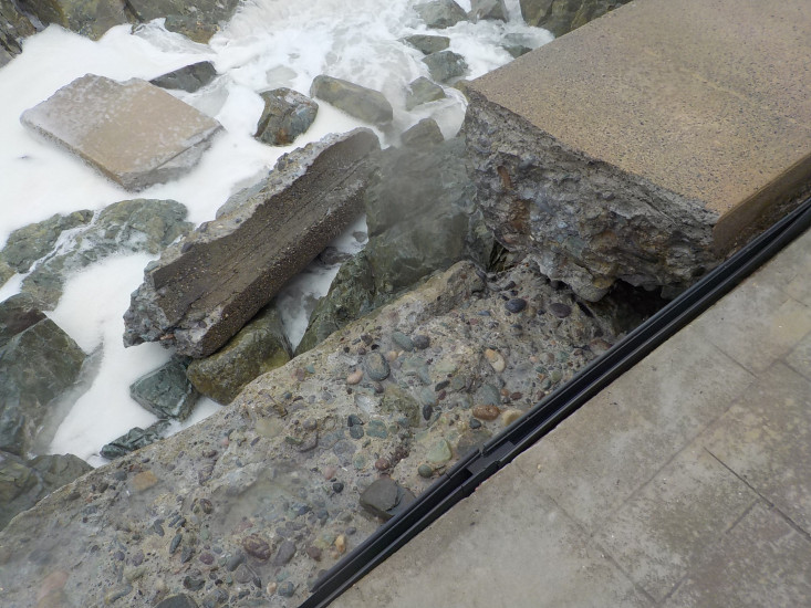
Coastal Structures
Specific Impacts:
- Splashover
- Collapsed bulkheads/seawalls
Comments: Approximately 50 liner feet of the upper portion of the seawall broke off allowing more water and debris to reach the houses.
Natural Resources
Current Response
Response:
- None
You must be logged in to post a comment.