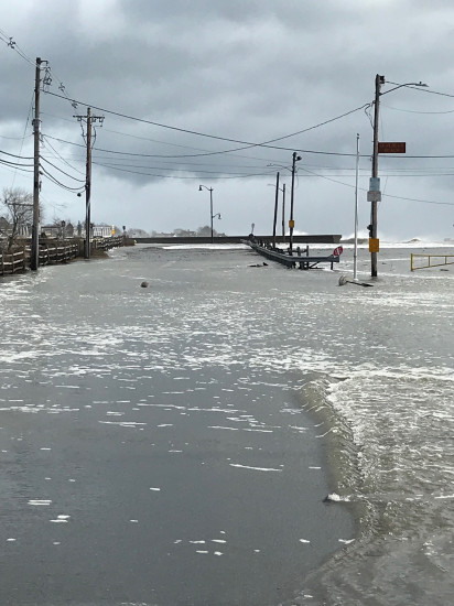
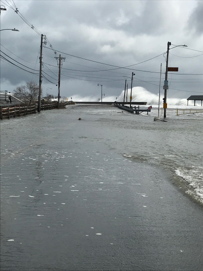
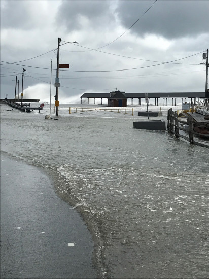
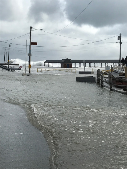
Marblehead, MA (Devereaux beach and Causeway Marblehead)
Essex County
Storm Report
03/03/2018 | 11:44 am
Impacts Reported

Roads
Street/Road: Unspecified
Specific Impacts:
- Impassable (flood water)
- Impassable (overwash)
- Impassable (other)
Specific road: Completely flooded with high water flows; never seen water this high; some waves are as high as pavilion rooftop
Marinas and Harbors
Comments: Storage area flooded
Buildings
Specific Impacts:
- Water flow around or under buildings
Comments: Restroom facility getting pounded by waves
Hazardous Materials
Beach
State: Inaccessible
Comments: Can’t even get close to beach
Coastal Structures
Specific Impacts:
- Splashover
Comments: Can’t tell about damage to seawall but the curved top is doing as good a job as it can
Natural Resources
Specific Impacts:
- Eroded beach
- Eroded dune
- Overwashed beach/dune
Current Response
Response:
- Other
Specific response: Blocked off roadway
You must be logged in to post a comment.