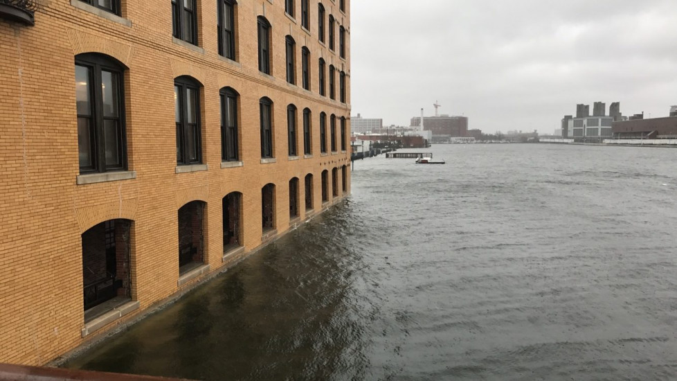
Boston, MA (Fort Point Channel harbor walk)

Suffolk County

Impacts Reported


Roads

Street/Road: Unspecified

Marinas and Harbors

Comments: Fort Point Channel Harborwalk flooded

Buildings

Specific Impacts:

  • Water flow around or under buildings

Hazardous Materials
Beach

State: Accessible

Coastal Structures
Natural Resources
Current Response

03/02/2018 | 11:15 am

Tidal Overview

0 hours 3 minutes before high tide

Data from BOSTON (0.3 miles away)

Water Level (at time of report): 11:15 am, 14.7'

High Tide (Predicted): 11:14 am, 11.4'

High Tide (Observed): 11:18 am, 14.6'

Observed Predicted water level Report time

Weather Overview

Wind Speed: 40.8 MPH

Wind Direction: NNE (30°)

Temperature: 41℉

Rainfall (Calendar Day): 0.163"

Rainfall (Past 24 Hours): 0.38"

(Click here for full weather details)


You must be logged in to post a comment.