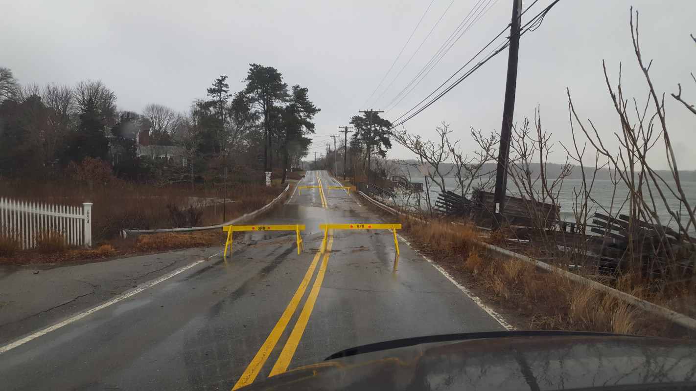
Harwich, MA (Rt 28 Harwich/Orleans)
Barnstable County
Storm Report
01/04/2018 | 3:24 pm
Impacts Reported
Roads
Street/Road: Unspecified
Specific Impacts:
- Impassable (flood water)
Comments: Two low lying areas along Rt 28 in Harwich and Orleans along Pleasant Bay were closed to traffic due to tidal floodwaters over roadway.
Marinas and Harbors
Buildings
Hazardous Materials
Beach
State: Accessible
Coastal Structures
Natural Resources
Current Response
You must be logged in to post a comment.