Barnstable County
Falmouth, MA
(Surf Drive)
Storm Report
User Submitted Data
Roads
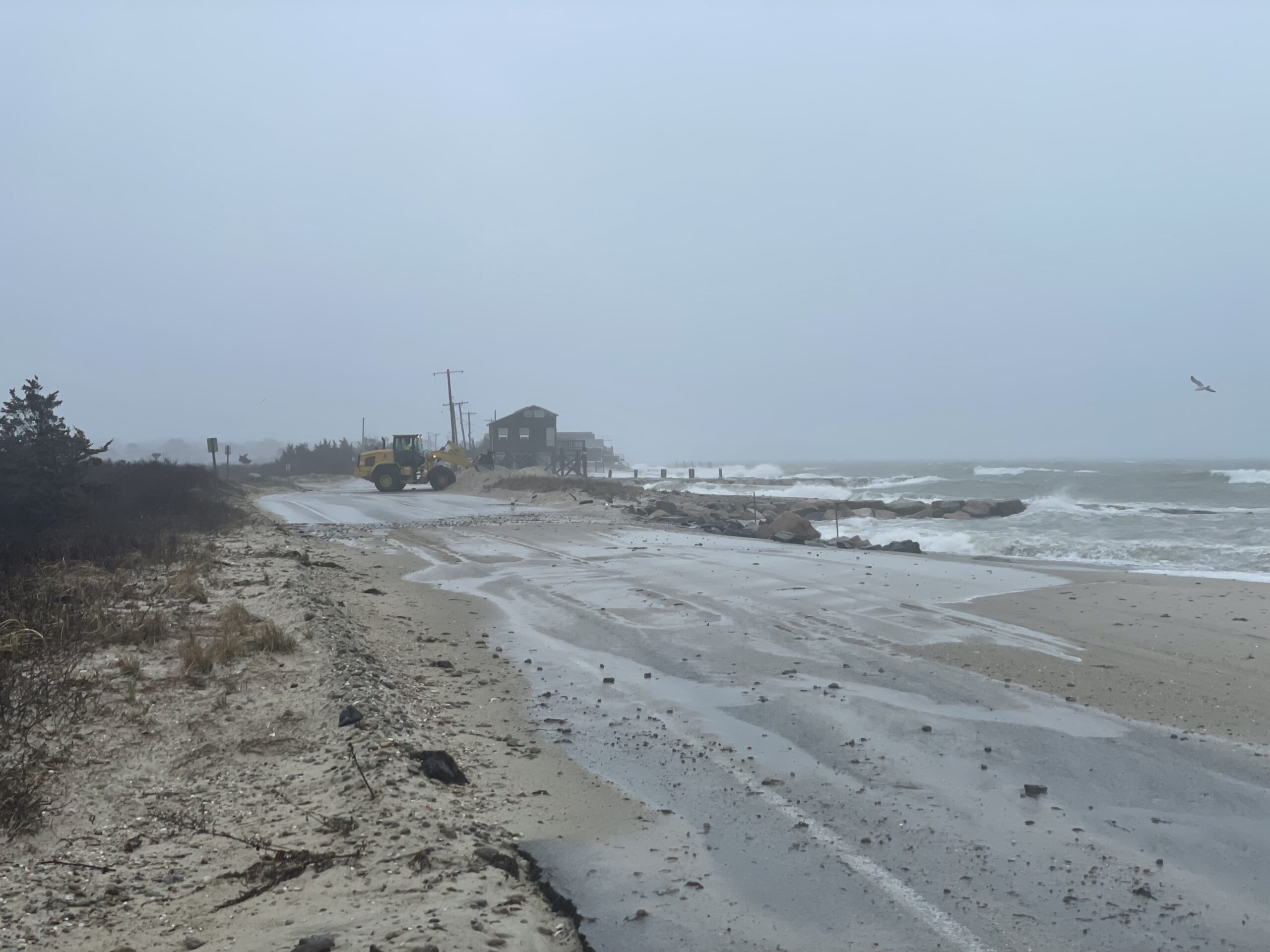
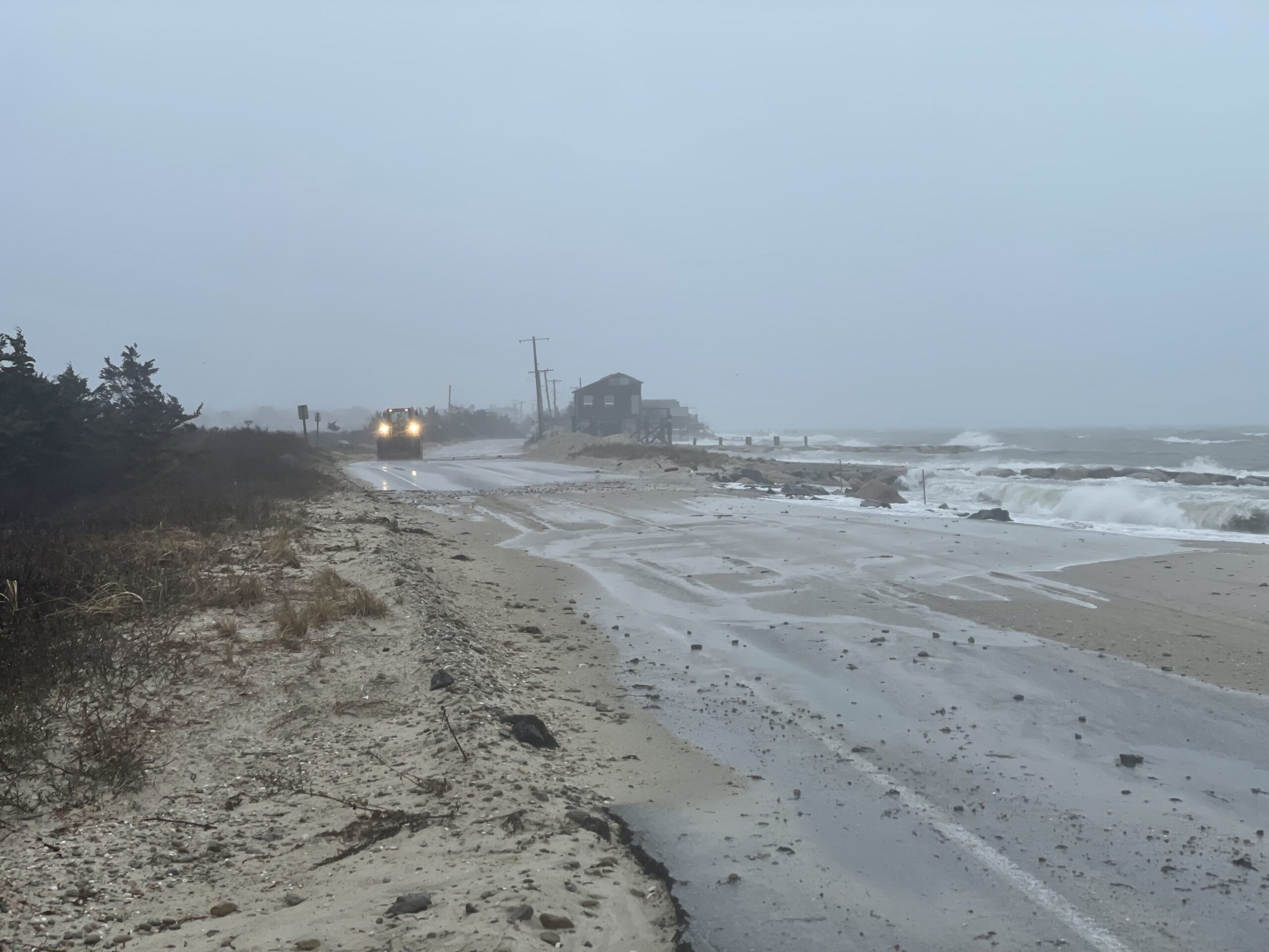
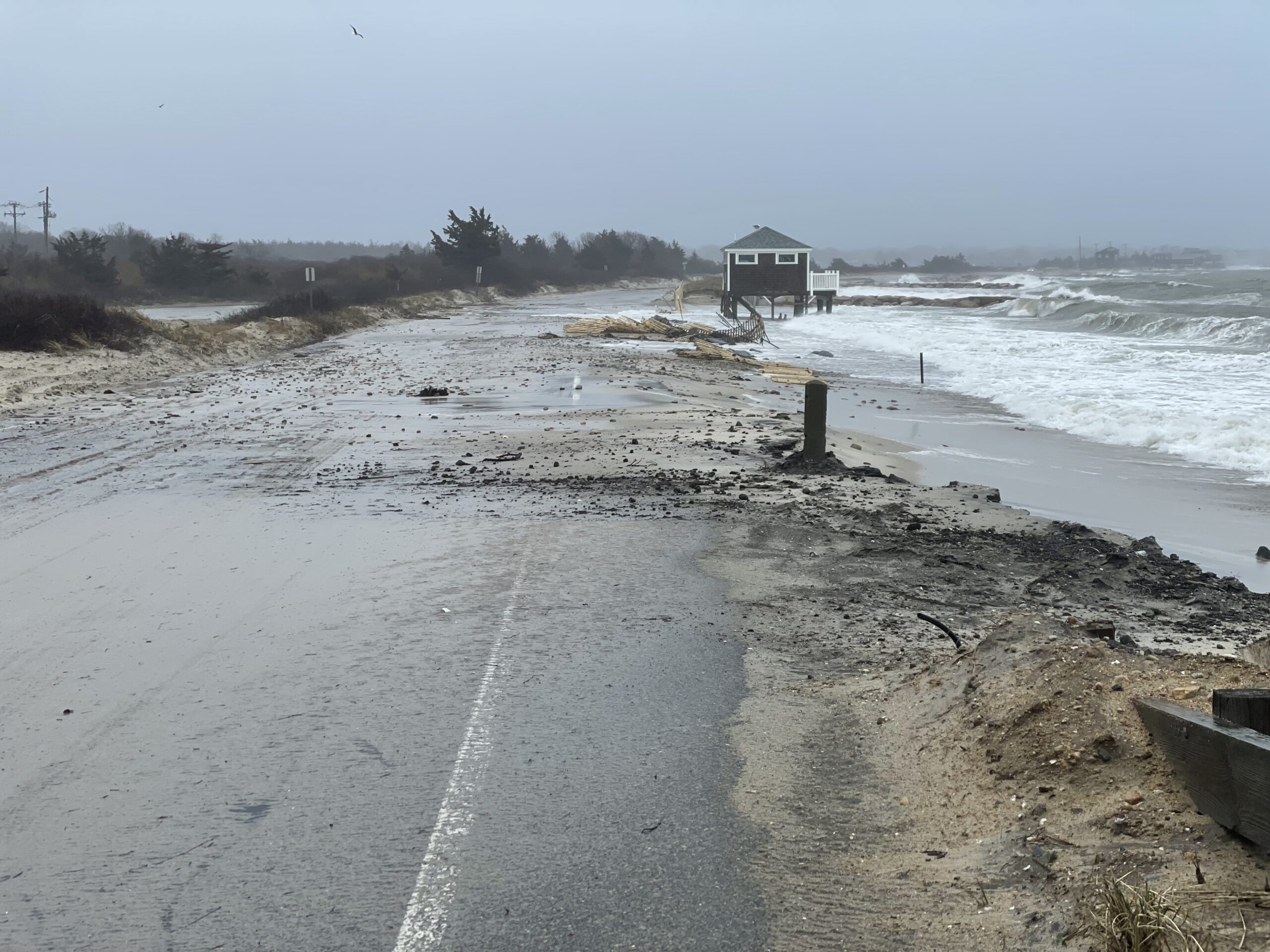
Street/Road: Surf Drive
Specific Impacts:
- Splashover
- Impacted, but passable
Comments: Overwash has spread debris and cobbles throughout multiple sections of the road. Heavy equipment on site to clear it. Still passible, but would likely become impassible if conditions get any worse.
Marinas and Harbors
Buildings
Hazardous Materials
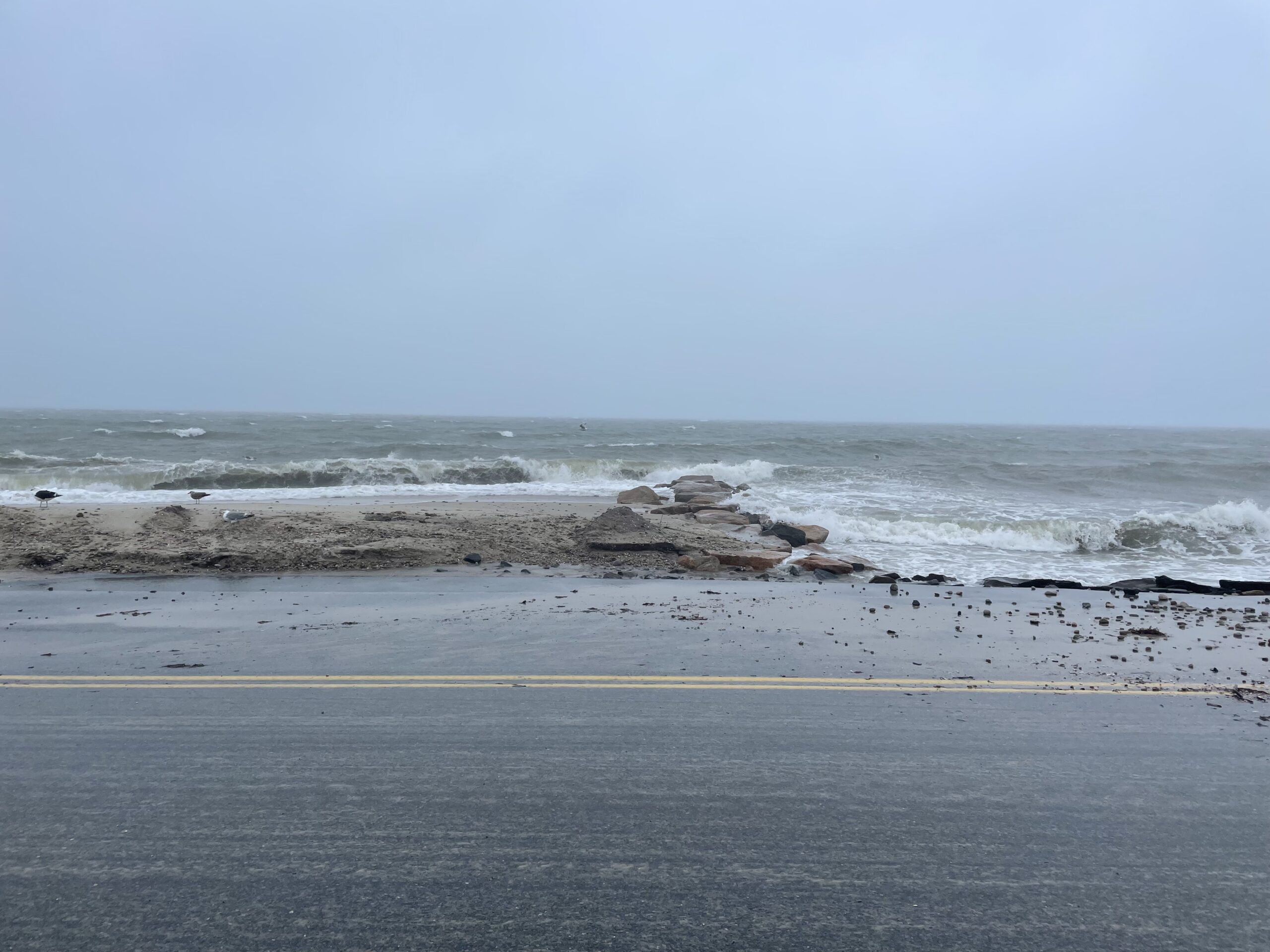
Beach
Imapacts Reported: Y
Comments: Beachface is completely in the surf zone, unsafe to access.
Coastal Structures
Foot/Cycling Paths
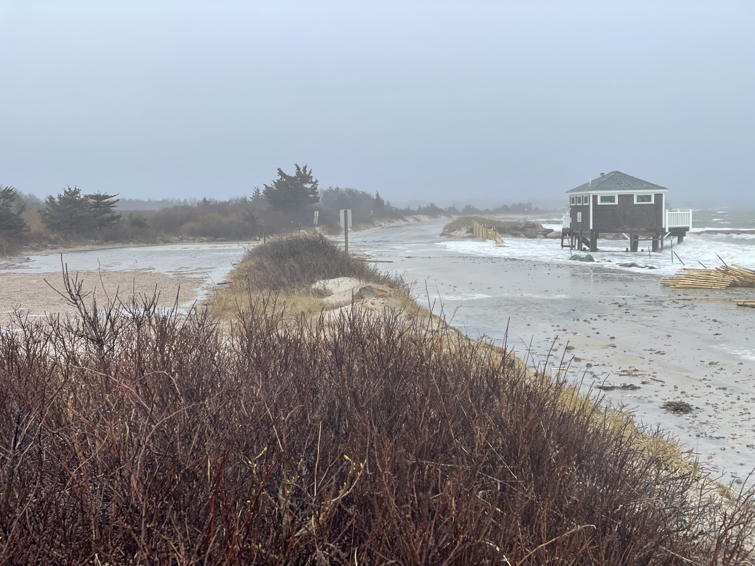
Natural Resources
Specific Impacts:
- Damaged sand fencing
- Eroded beach
- Eroded dune
- Overwashed beach/dune
Comments: Sections of sand fencing has been destroyed. Dune erosion and overwash visible. Beach is currently inaccessible, but significant erosion is highly likely given current conditions.
Current Response
Response:
- Road clearing
Tidal Overview
![]() 4 hours 7 minutes after high tide
4 hours 7 minutes after high tide
Data from OCEANOGRAPHIC INSTITUTION (2.5 miles away)
Water Level (at time of report): 8:31 am, 3.8' MLLW
High Tide (Predicted): 5:06 am, 2' MLLW
High Tide (Observed): 4:24 am, 4.5' MLLW
Loading NOAA Tide Data…
Weather Overview
Wind Speed: 18.5 MPH
Wind Direction: ENE (62°)
Temperature: 43℉
Rainfall (Calendar Day): 0.017"
Rainfall (Past 24 Hours): 1.37"