593bad569127b8bf4926d483d6358fa843fb2653
2ca4f8181e03f60cc16d85cd82d53a46f7ce6445
What is Flooded:
Estimated water depth: 8 inches
3 hours 30 minutes before high tide
Data from North Channel Bridge, Grassy Bay (2.7 miles away)
High Tide (Predicted): 8:30 pm, 6'
(Click here for full tide details from NOAA Tides & Currents)
Wind Speed: 13.1 MPH
Wind Direction: W (269°)
Temperature: 50℉
Rainfall (Calendar Day): 0"
Rainfall (Past 24 Hours): 0.43"
(Click here for full weather details)
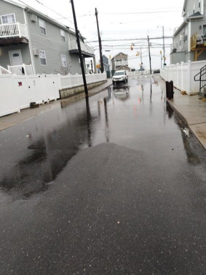
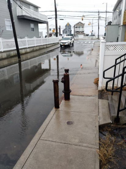
"Most of the flooding pictures from 6th road are multiple cause flooding, with rain pooling Plus water not being able to drain from the storm drains and backing up into the street"