Roads
Street/Road: Unspecified
Specific Impacts:
- Impacted, but passable
- Impassable (flood water)
Marinas and Harbors
Buildings
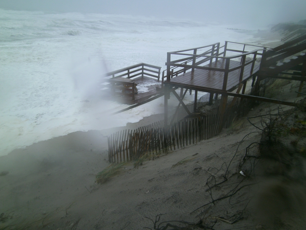
Street: 101 Foster Rd
Specific Impacts:
- Damaged stairs/decks
- Water flow around or under buildings
Hazardous Materials
Beach
Foot/Cycling Paths
Natural Resources
Specific Impacts:
- Eroded beach
Current Response
Response:
- None
You must be logged in to post a comment.
"this site also known as Saltmarsh Road. Deck belongs to house directly east of 101 Foster Rd. Water/erosion under 101 Foster but could not access to fully assess."