Roads
Street/Road: Unspecified
Marinas and Harbors
Buildings
Hazardous Materials
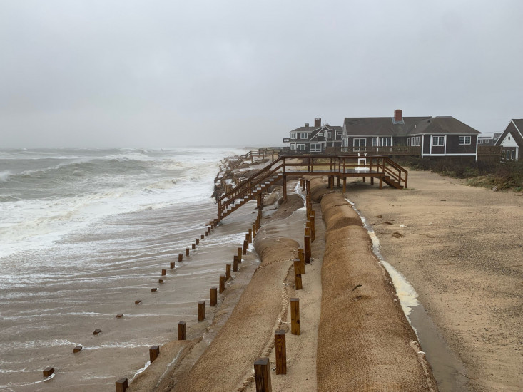
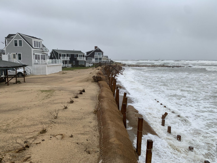
Beach
State: Accessible
Coastal Structures
Natural Resources
Specific Impacts:
- Damaged sand fencing
- Eroded beach
- Eroded dune
Comments: Lots of the sand from the beach stabilization project has gone land word on to the lawns in front of the houses along whitecap pass. The beach is much lower and much of the sand that was on the core envelopes has been removed. Many of the posts are at an angle.
Current Response
You must be logged in to post a comment.