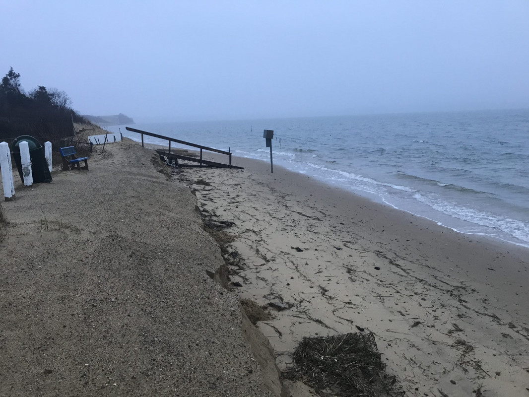
Chatham, MA (Strong Island Landing)
Barnstable County
Storm Report
02/02/2021 | 7:24 am
Impacts Reported
Roads
Street/Road: Unspecified
Marinas and Harbors
Buildings
Hazardous Materials
Beach
State: Accessible
Coastal Structures
Natural Resources
Specific Impacts:
- Eroded beach
- Eroded dune
- Eroded bank/bluff
Comments: "Typical" erosion of dunes/bank from elevated storm surge with strong NE winds.
Current Response
Response:
- Other
Specific response: Will provide additional sacrificial nourishment.
You must be logged in to post a comment.