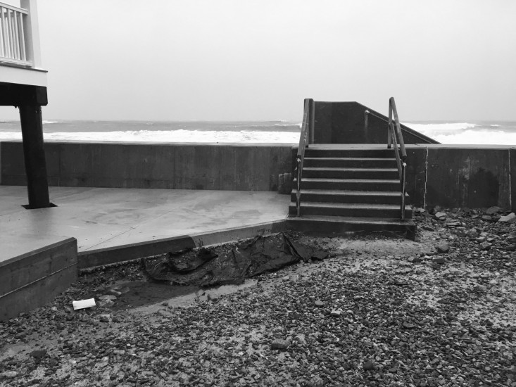
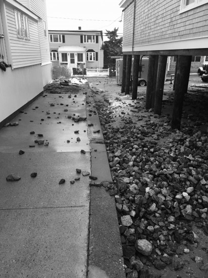
Marshfield, MA (Bay Avenue Seawall)
Plymouth County
Storm Report
12/17/2020 | 3:48 pm
Impacts Reported
Roads
Street/Road: Unspecified
Marinas and Harbors
Buildings
Hazardous Materials
Beach
State: Accessible
Coastal Structures
Natural Resources
Current Response
Response:
- None
You must be logged in to post a comment.
"Minor erosion due to overwash."