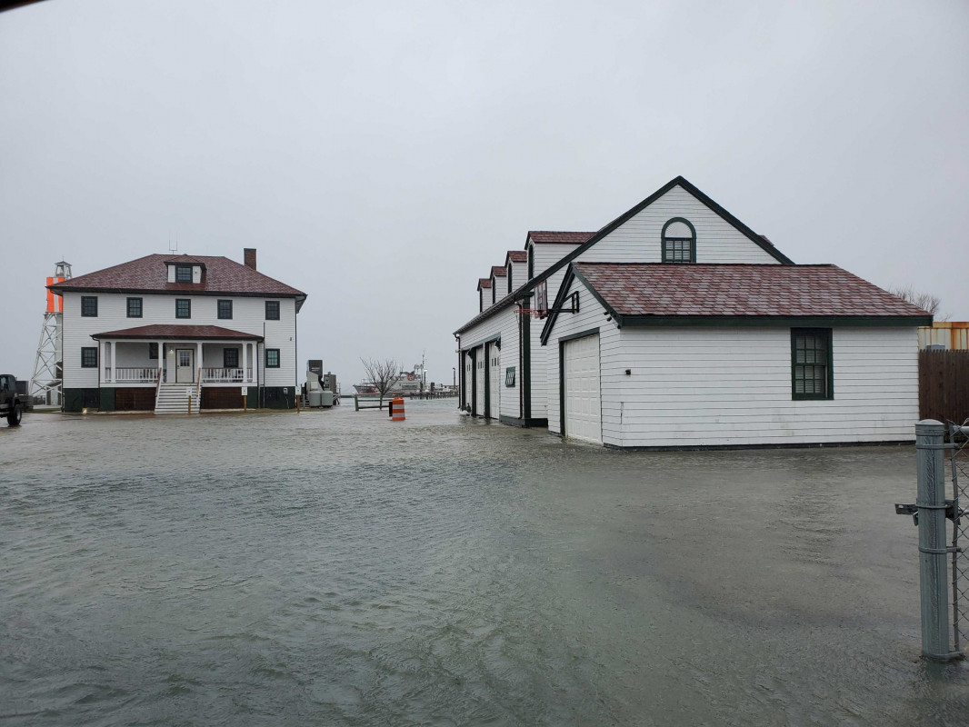
Nantucket, MA (US Coast guard Brant Point)
Nantucket County
Storm Report
04/03/2020 | 8:25 am
Impacts Reported
Roads
Street/Road: Unspecified
Specific Impacts:
- Impassable (flood water)
Comments: Harbor water comming through the coast guard property.
Marinas and Harbors
Buildings
Street: Easton Street
Specific Impacts:
- Water flow around or under buildings
Hazardous Materials
Beach
State: Accessible
Coastal Structures
Natural Resources
Current Response
You must be logged in to post a comment.