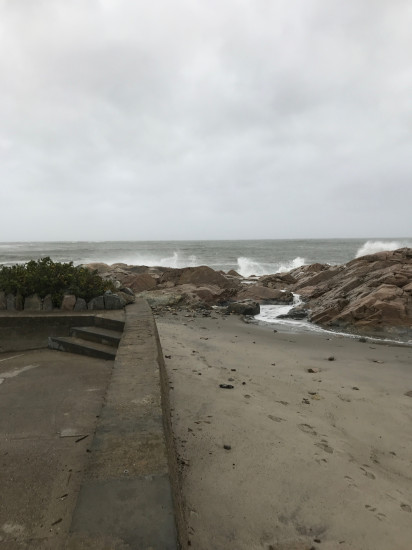
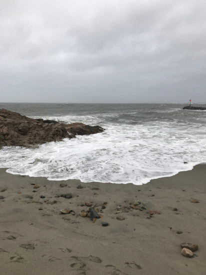
Marshfield, MA (Bluefish Cove-Brant Rock)

Plymouth County

Impacts Reported


Roads

Street/Road: Unspecified

Marinas and Harbors
Buildings
Hazardous Materials
Beach

State: Accessible

Coastal Structures

Specific Impacts:

  • Splashover

Natural Resources

Specific Impacts:

  • Eroded beach

Current Response

10/11/2019 | 8:43 am

Tidal Overview

2 hours 2 minutes before high tide

Data from Brant Rock, Green Harbor River (0.4 miles away)

High Tide (Predicted): 10:45 am, 8.8'

Observed Predicted water level Report time

Weather Overview

Wind Speed: 12.6 MPH

Wind Direction: NNE (30°)

Temperature: 57℉

Rainfall (Calendar Day): 0.009"

Rainfall (Past 24 Hours): 0.13"

(Click here for full weather details)


You must be logged in to post a comment.