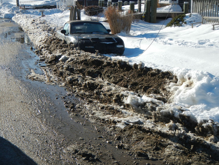
Roads
Street/Road: Unspecified
Specific Impacts:
- Splashover
- Impacted, but passable
- Impassable (overwash)
- Impassable (washed out)
Comments: debris, sand and cobble has been cleared. End of East Street washed out and undermoned
Marinas and Harbors
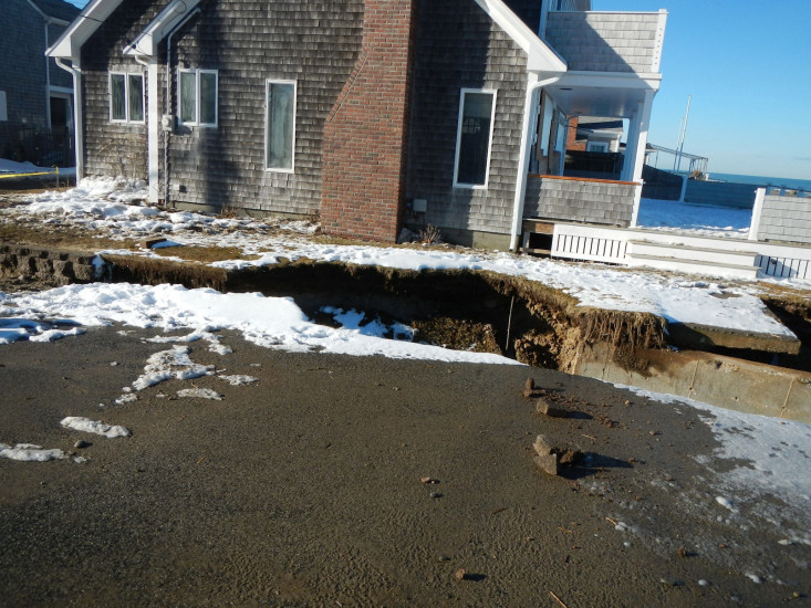
Buildings
Specific Impacts:
- Water flow around or under buildings
- Damaged stairs/decks
- Damaged windows/sidings
Comments: Sump Pump mat 6 East Street pumping out basement, icing of houses, decks undermined
Hazardous Materials
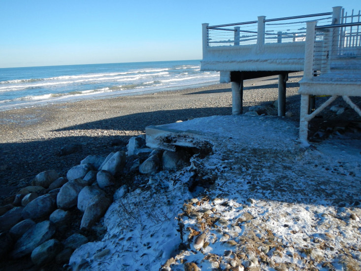
Beach
State: Accessible
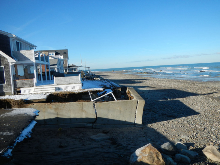
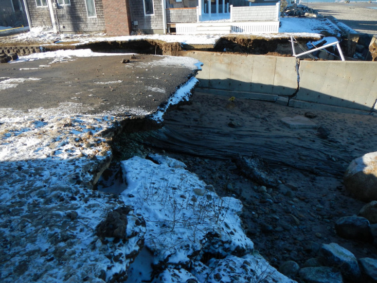
Coastal Structures
Specific Impacts:
- Splashover
- Collapsed bulkheads/seawalls
Comments: 70 feet of concrete seawall collapsed at corner (Private), Revetment shifted, moved & slumped under deck
Natural Resources
Specific Impacts:
- Eroded beach
- Overwashed beach/dune
Current Response
You must be logged in to post a comment.